

Sometimes an artwork is not merely an expression of the artist—rather, it is a legal document, or perhaps a blueprint, or even a map. At The Conservation Center, we love coming across pieces that are not only beautiful, but also informative. This was just the case with a piece recently treated for Battle Creek-based private collector, Greg Allen. The said piece is by John Farmer (1798–1859), who is recognized for his cartography of early 19th century Michigan. What makes his maps so incredible is that they serve as primary sources of history for this region.
John Farmer is perhaps the single most important map maker and surveyor in the history of the mapping of Michigan. In 1821, Farmer was commissioned by Governor Cass and the trustees of the University of Michigan to survey and create the first published map of Michigan. To complete this project, Farmer moved from Albany, New York to Michigan. In 1825, he issued the first of a number of maps of Michigan, Wisconsin, Lake Superior, and Detroit; most of which he also engraved. In 1831, Farmer compiled and drew the first and only map of Detroit for the governor and judges of Michigan. Farmer’s early maps were extremely influential in promoting the extensive emigration to Michigan that occurred between 1825 and 1840.


John Farmer’s son, Silas, was born in Detroit, Michigan in 1839 and was brought up working in his father's business, where he continued the publication of maps well into the 1880s. For a period of time, Farmer’s maps were licensed to J.H. Colton, a mapmaking company that was an international leader in the map publishing industry between 1831 and 1890.
The map treated by The Center was created by Farmer in 1836 and was brought in by a lifelong cartography enthusiast and Michigan resident, Greg Allen. He has a large collection of maps which document the areas surrounding the Great Lakes. The earliest map in the collection was engraved in 1650s and is the first in the series that shows the region in recognizable form. The Farmer map from 1836 is the last map of Michigan before the state was admitted to the union and was also the last map engraved by Farmer before he sold his business to J.H. Colton. Greg purchased this map in May 2013 from a dealer in New York City, Donald A. Heald Rare Books, Prints and Maps.
“This Farmer map is special to our area in Calhoun County (south central) because it is the only known map to show the area of Battle Creek as Milton, as it was once known,” Greg said. “However, the most amazing thing to most people is not only how big this map is (20” x 31 ½”), but the fact that it folds up into a cover that is only 3 ½” x 5 ¾”. This was the primary source of marketing for the Michigan Territory after the Erie Canal opened up in the mid 1820s. In fact, it is entirely possible that my great-great grandfather could have used a map like this when he came from New York state to Michigan to purchase land in 1838.”
With the use of conservation-quality materials, properly framed artworks will have the best chance for long life. That’s why Greg did not think twice about bringing the John Farmer map to The Center for custom framing. Our custom framers first picked out the appropriate mat color. In this particular case, a fabric was chosen that was sympathetic to the paper tone so as not to detract from the artistry of the map. Our framer decided on an eight-ply wrapped mat on top of a four-ply colored fabric mat—so the same fabric that the item is floated on is also used for the wrap. The work was float-mounted because the cartography goes all the way to the edge of the parchment. Had the map been traditionally mounted under a mat with a margin, the details on the edges of the sheet would have been lost on the viewer. To flat mount the work, a two-ply board is cut slightly smaller than the artwork. The map, in this case, was mounted to the board which is then mounted to the fabric of the other wrapped mount, giving the illusion that the map is floating above the mounts. When it came to installing the glazing into the frame, The Center recommended True Vue Museum Glass—a conservation grade glass that protects against harmful UV rays—to protect the map. Museum Glass blocks up to 99% of UV light rays to prevent fading.


For this project, The Center worked with Greg to not only mount and frame, but to also showcase the historical map instructions written by John Farmer. These were encapsulated and displayed on the verso of the backing board, so the piece itself could be displayed in all its grandeur, but the viewer would not miss any details covered up by the conservation framing. According to Greg, “The real gem is in the pocket cover framing/stand. The experts at The Conservation Center understood why I wanted to have the instructions encapsulated so we could appreciate the instructions as well as the front cover. They came up with an ingenious solution that greatly enhances this fine piece of work.”

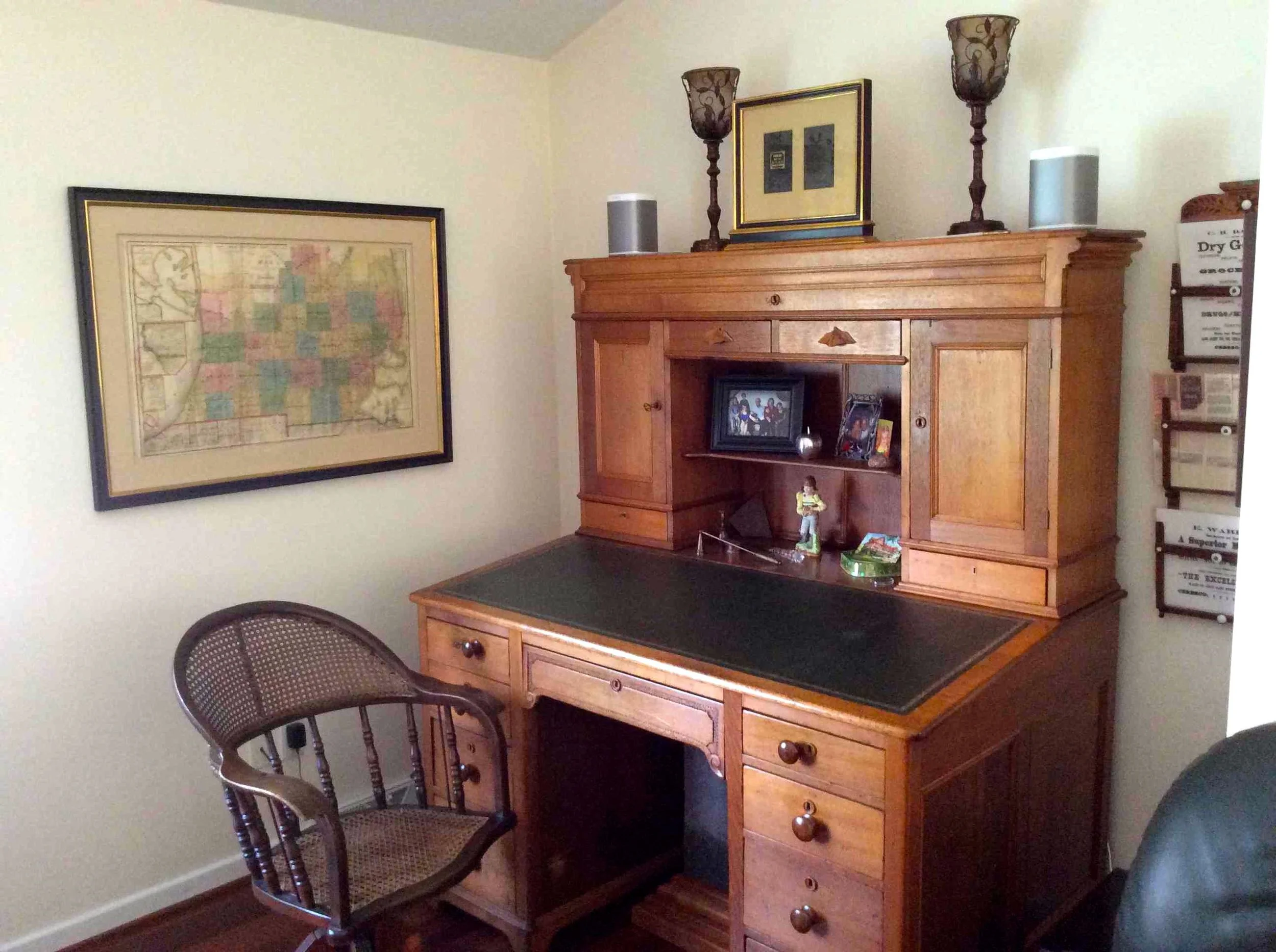
The 1836 John Farmer map of Michigan is now displayed proudly at Greg’s home in Battle Creek. “The map is positioned next to a desk that was owned by another of my great-great grandfathers. This desk dates to the 1870s and was purchased by my great-great grandfather after he became the postmaster in a little town in south central Michigan called Ceresco. The desk looks identical to the No. 13 Large Desk shown in the 1871 catalogue of J. Brewi & Co. This desk sat in the first floor front room for over 90 years until my grandparents moved to Battle Creek in the 1960s. I refinished the desk in 1979 and added the Italian leather 8 years ago.”
We could not have been happier with the way this particular project finished—and Greg concurs. “I knew once I purchased the map that I would have The Conservation Center mount and frame it. Your ability to create any desired look or tone with a given frame was exactly what I was expecting for this special project…everyone at The Conservation Center did a fantastic job.”
